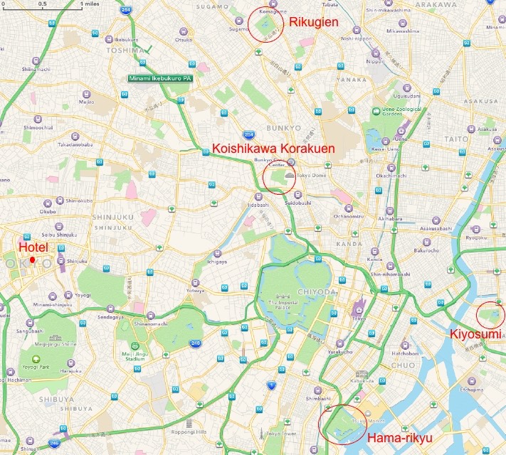
The four gardens I had chosen to visit were widely distributed across Tokyo. Research had indicated that the best way to get around would be by subway/metro trains. I planned to make a counter-clockwise loop, so first was Hama-rikyu, followed by Kiyosumi, Rikugien and Koishikawa Korakuen.
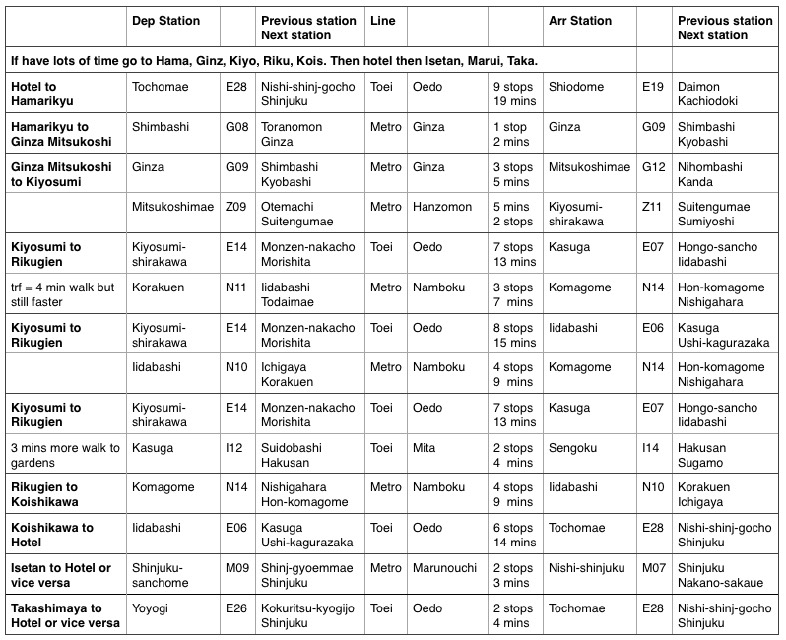
I had a spreadsheet of possible routes between each garden with the name of the line, departure station, arrival station, previous and next station names for both, number of stops and estimated time.
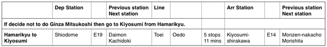
I also had to have an amendment because I had decided not to go to Ginza.
The subway map for Tokyo is extraordinarily complicated so I had made smaller maps with just the relevant part for each step of the route. And I had walking maps to get me from the stations to the gardens and back again. Armed with all this, I left the hotel, at 8:30 a.m. and walked to Tochomae station on the Toei Oedo line, just a couple of minutes from the hotel. The only complication was that the roads around the hotel were at different levels, depending on which side of the hotel you exited. Some were overpasses, others were almost below ground - a little confusing. But I got to the station and was able to bypass the ticket machines because I had the pass that I had bought from the Limo Bus people at Narita. Finally I was on my way to my first Japanese garden.
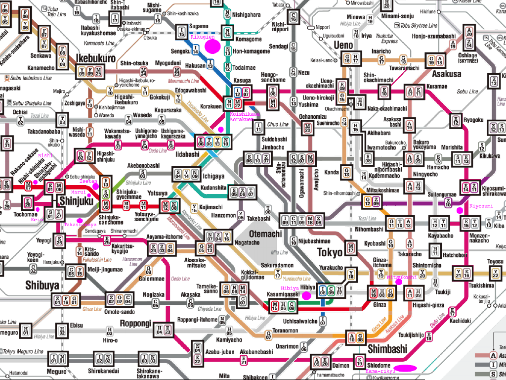
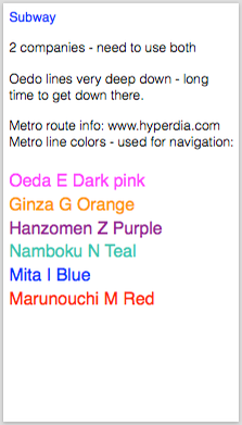
Subway map (click for larger map)